Details
Four Peak, south of Hwy87 from FR143
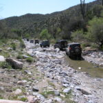
The Four Peaks area and the El Oso Mine trail is a great place to explore within a short drive from Phoenix. I wanted to lead a trail for the 4x4wire Arizona Isuzu and Mitsubishi group, and felt that this trail would make the perfect introduction. We met at the start of the El Oso (four peaks) road, with everyone showing up at about 9:30. We made introductions and started to air down in preparation for the 18 mile drive on the graded road (designated FR143). This area is popular for all OHV users, so quads and trail bikes are to be expected, especially close to the highway.
Climb in elevation in the Mazatzal Mountains on FR143. This road eventually ends at Punkin Center NW of Theodore Roosevelt Lake. The trail rises to over 5,000′ and reaches a saddle at Pine Mountain. This is where FR422 (Edwards Trail) heads north leaving FR143. This road is still tame and has a few steep climbs, but traction is good. At FR463 (N33 44.741 W111 22.175 NAD83) we left the main the El Oso mine trail (FR422) and start on the Joline Mine trail. This is where all of the challenges are encountered.
Within a few hundred yards of FR463, the trail yields some challenges, including some nice slabs that will test the suspension travel of the vehicle. This portion of the trail runs along a ridge overlooking Big Pine Flat, with some nice views. This area was damaged by fire many years ago, and is now just recovering. The brush here is very tight, and is the worst you will find throughout the loop.
Location
Address: